
- Start >
- Rivers >
- Waterlevel >
- Obere Donau >
- Weißenburg >
- Chart of month

Chart of month Weißenburg / Schwäbische Rezat
Waterlevel from 01.04.2021 to 01.05.2021
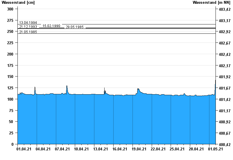
- 13.04.1994 Wasserstand: 266 cm
- 15.02.1990 Wasserstand: 259 cm
- 21.12.1993 Wasserstand: 257 cm
- 29.05.1985 Wasserstand: 256 cm
- 21.05.1985 Wasserstand: 245 cm
| Date | Waterlevel [cm] |
|---|---|
| 02.05.2021 00:45 | 146 |
| 02.05.2021 00:30 | 146 |
| 02.05.2021 00:15 | 145 |
| 02.05.2021 00:00 | 145 |
| 01.05.2021 23:45 | 144 |
| 01.05.2021 23:30 | 143 |
| 01.05.2021 23:15 | 140 |
© Bayerisches Landesamt für Umwelt 2024