
- Start >
- Rivers >
- Waterlevel >
- Obere Donau >
- Wasserburg >
- Chart of year

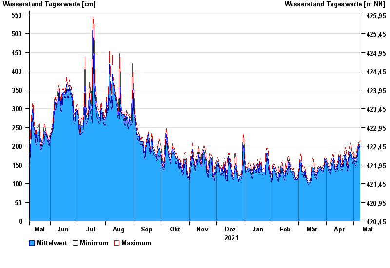
Chart of year Wasserburg / Inn
Waterlevel from 09.05.2021 to 08.05.2022
- 23.08.2005 Wasserstand: 719 cm
- 07.08.1985 Wasserstand: 670 cm
- 21.05.1999 Wasserstand: 638 cm
- 02.06.2013 Wasserstand: 630 cm
- 20.07.1981 Wasserstand: 615 cm
| Date | Mean value [cm] | Maximum [cm] | Minimum [cm] |
|---|---|---|---|
| 08.05.2022 | 201 | 214 | 191 |
| 07.05.2022 | 207 | 212 | 202 |
| 06.05.2022 | 197 | 204 | 189 |
| 05.05.2022 | 184 | 195 | 176 |
| 04.05.2022 | 172 | 184 | 156 |
| 03.05.2022 | 157 | 166 | 147 |
| 02.05.2022 | 158 | 165 | 152 |
© Bayerisches Landesamt für Umwelt 2024