
- Start >
- Rivers >
- Waterlevel >
- Obere Donau >
- Wasserburg >
- Chart of month

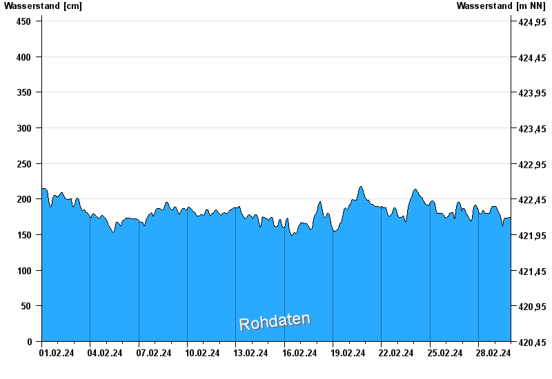
Chart of month Wasserburg / Inn
Waterlevel from 01.02.2024 to 29.02.2024
- 23.08.2005 Wasserstand: 719 cm
- 07.08.1985 Wasserstand: 670 cm
- 21.05.1999 Wasserstand: 638 cm
- 02.06.2013 Wasserstand: 630 cm
- 20.07.1981 Wasserstand: 615 cm
| Date | Waterlevel [cm] |
|---|---|
| 29.02.2024 23:45 | 172 |
| 29.02.2024 23:30 | 172 |
| 29.02.2024 23:15 | 173 |
| 29.02.2024 23:00 | 174 |
| 29.02.2024 22:45 | 174 |
| 29.02.2024 22:30 | 174 |
| 29.02.2024 22:15 | 174 |
© Bayerisches Landesamt für Umwelt 2024