
- Start >
- Rivers >
- Waterlevel >
- Obere Donau >
- Waldstetten >
- Chart of year

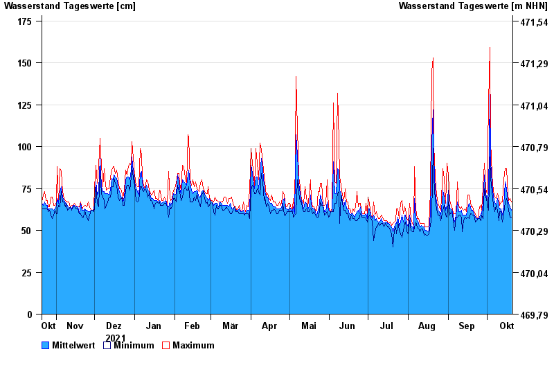
Chart of year Waldstetten / Günz
Waterlevel from 21.10.2021 to 20.10.2022
- 12.08.2002 Wasserstand: 279 cm
- 11.06.2013 Wasserstand: 270 cm
- 19.06.1991 Wasserstand: 265 cm
- 22.09.2000 Wasserstand: 256 cm
- 30.05.2007 Wasserstand: 255 cm
| Date | Mean value [cm] | Maximum [cm] | Minimum [cm] |
|---|---|---|---|
| 20.10.2022 | 62 | 67 | 58 |
| 19.10.2022 | 64 | 69 | 58 |
| 18.10.2022 | 66 | 68 | 62 |
| 17.10.2022 | 68 | 71 | 65 |
| 16.10.2022 | 75 | 87 | 69 |
| 15.10.2022 | 79 | 87 | 67 |
| 14.10.2022 | 65 | 80 | 60 |
© Bayerisches Landesamt für Umwelt 2024