
- Start >
- Rivers >
- Waterlevel >
- Obere Donau >
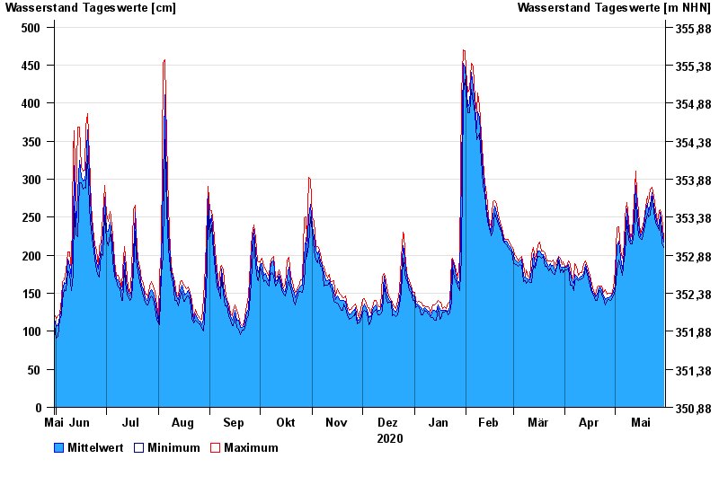
- Vohburg >
- Chart of year

Chart of year Vohburg / Donau
Waterlevel from 31.05.2020 to 30.05.2021
- 24.05.1999 Wasserstand: 765 cm
- 25.08.2005 Wasserstand: 657 cm
- 15.04.1994 Wasserstand: 643 cm
- 15.05.1999 Wasserstand: 634 cm
- 14.08.2002 Wasserstand: 632 cm
| Date | Mean value [cm] | Maximum [cm] | Minimum [cm] |
|---|---|---|---|
| 30.05.2021 | 217 | 222 | 210 |
| 29.05.2021 | 234 | 252 | 216 |
| 28.05.2021 | 256 | 260 | 251 |
| 27.05.2021 | 238 | 257 | 233 |
| 26.05.2021 | 241 | 245 | 238 |
| 25.05.2021 | 252 | 259 | 242 |
| 24.05.2021 | 265 | 278 | 258 |
© Bayerisches Landesamt für Umwelt 2024