
- Start >
- Rivers >
- Waterlevel >
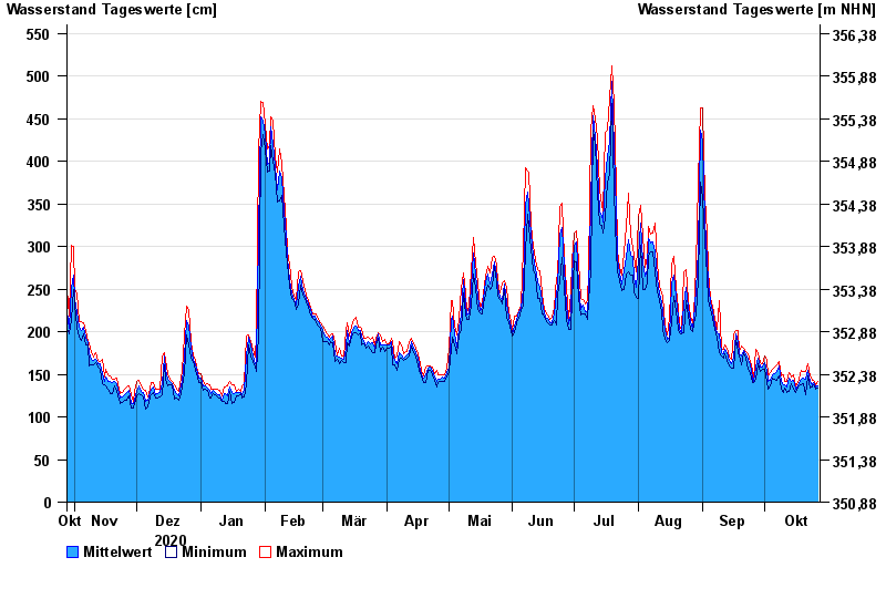
- Obere Donau >
- Vohburg >
- Chart of year

Chart of year Vohburg / Donau
Waterlevel from 28.10.2020 to 27.10.2021
- 24.05.1999 Wasserstand: 765 cm
- 25.08.2005 Wasserstand: 657 cm
- 15.04.1994 Wasserstand: 643 cm
- 15.05.1999 Wasserstand: 634 cm
- 14.08.2002 Wasserstand: 632 cm
| Date | Mean value [cm] | Maximum [cm] | Minimum [cm] |
|---|---|---|---|
| 27.10.2021 | 137 | 142 | 134 |
| 26.10.2021 | 135 | 138 | 133 |
| 25.10.2021 | 140 | 143 | 138 |
| 24.10.2021 | 138 | 143 | 135 |
| 23.10.2021 | 141 | 148 | 134 |
| 22.10.2021 | 154 | 162 | 148 |
| 21.10.2021 | 144 | 153 | 126 |
© Bayerisches Landesamt für Umwelt 2024