
- Start >
- Rivers >
- Waterlevel >
- Obere Donau >
- Vohburg >
- Chart of year

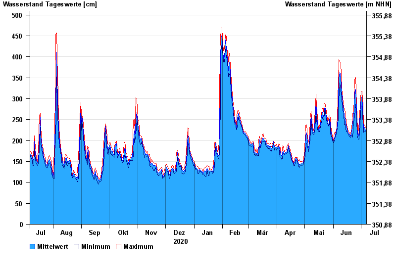
Chart of year Vohburg / Donau
Waterlevel from 07.07.2020 to 06.07.2021
- 24.05.1999 Wasserstand: 765 cm
- 25.08.2005 Wasserstand: 657 cm
- 15.04.1994 Wasserstand: 643 cm
- 15.05.1999 Wasserstand: 634 cm
- 14.08.2002 Wasserstand: 632 cm
| Date | Mean value [cm] | Maximum [cm] | Minimum [cm] |
|---|---|---|---|
| 06.07.2021 | 224 | 232 | 221 |
| 05.07.2021 | 231 | 238 | 221 |
| 04.07.2021 | 226 | 239 | 220 |
| 03.07.2021 | 255 | 282 | 239 |
| 02.07.2021 | 305 | 318 | 282 |
| 01.07.2021 | 302 | 316 | 283 |
| 30.06.2021 | 267 | 283 | 239 |
© Bayerisches Landesamt für Umwelt 2024