
- Start >
- Rivers >
- Waterlevel >
- Obere Donau >
- Thann >
- Chart of year

Chart of year Thann / Altmühl
Waterlevel from 28.10.2020 to 27.10.2021
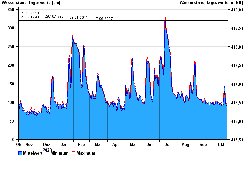
- 01.06.2013 Wasserstand: 335 cm
- 29.10.1998 Wasserstand: 327 cm
- 21.12.1993 Wasserstand: 324 cm
- 08.01.2011 Wasserstand: 323 cm
- 17.06.2007 Wasserstand: 320 cm
| Date | Mean value [cm] | Maximum [cm] | Minimum [cm] |
|---|---|---|---|
| 27.10.2021 | 91 | 93 | 88 |
| 26.10.2021 | 94 | 97 | 92 |
| 25.10.2021 | 97 | 100 | 92 |
| 24.10.2021 | 103 | 116 | 95 |
| 23.10.2021 | 133 | 149 | 116 |
| 22.10.2021 | 146 | 150 | 135 |
| 21.10.2021 | 116 | 135 | 95 |
© Bayerisches Landesamt für Umwelt 2024