
- Start >
- Rivers >
- Waterlevel >
- Obere Donau >
- Thann >
- Chart of year

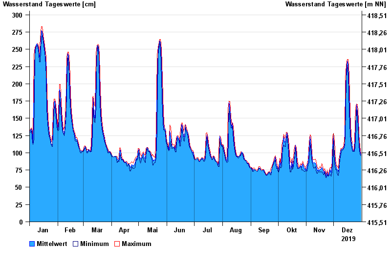
Chart of year Thann / Altmühl
Waterlevel from 01.01.2019 to 31.12.2019
- 01.06.2013 Wasserstand: 335 cm
- 29.10.1998 Wasserstand: 327 cm
- 21.12.1993 Wasserstand: 324 cm
- 08.01.2011 Wasserstand: 323 cm
- 17.06.2007 Wasserstand: 320 cm
| Date | Mean value [cm] | Maximum [cm] | Minimum [cm] |
|---|---|---|---|
| 31.12.2019 | 97 | 98 | 96 |
| 30.12.2019 | 103 | 110 | 98 |
| 29.12.2019 | 117 | 126 | 110 |
| 28.12.2019 | 137 | 149 | 126 |
| 27.12.2019 | 160 | 170 | 149 |
| 26.12.2019 | 170 | 171 | 165 |
| 25.12.2019 | 139 | 165 | 117 |
© Bayerisches Landesamt für Umwelt 2024