
- Start >
- Rivers >
- Waterlevel >
- Obere Donau >
- Thann >
- Chart of year

Chart of year Thann / Altmühl
Waterlevel from 01.01.2021 to 31.12.2021
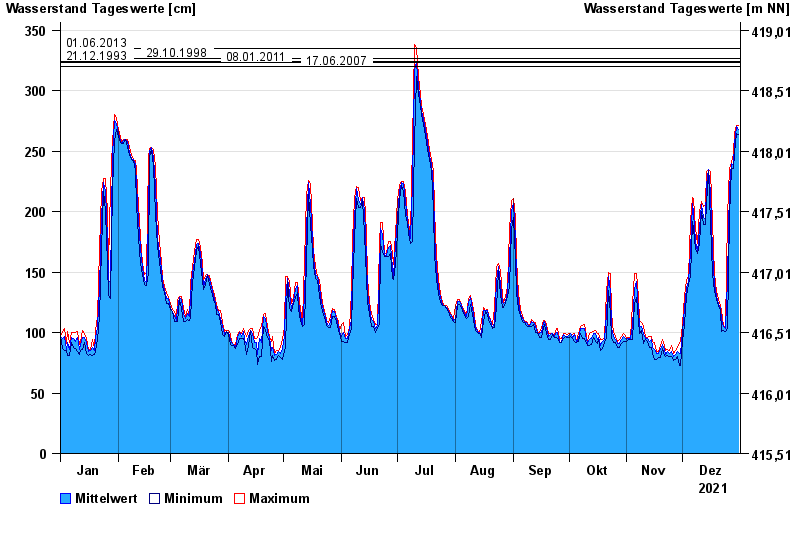
- 01.06.2013 Wasserstand: 335 cm
- 29.10.1998 Wasserstand: 327 cm
- 21.12.1993 Wasserstand: 324 cm
- 08.01.2011 Wasserstand: 323 cm
- 17.06.2007 Wasserstand: 320 cm
| Date | Mean value [cm] | Maximum [cm] | Minimum [cm] |
|---|---|---|---|
| 31.12.2021 | 268 | 271 | 264 |
| 30.12.2021 | 270 | 271 | 265 |
| 29.12.2021 | 256 | 265 | 248 |
| 28.12.2021 | 239 | 248 | 236 |
| 27.12.2021 | 240 | 241 | 236 |
| 26.12.2021 | 220 | 236 | 197 |
| 25.12.2021 | 144 | 197 | 103 |
© Bayerisches Landesamt für Umwelt 2024