
- Start >
- Rivers >
- Waterlevel >
- Obere Donau >
- Schmidmühlen >
- Chart of total period

Chart of total period Schmidmühlen / Vils
Waterlevel from 01.11.1969 to 27.04.2024
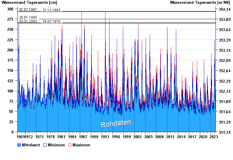
- 02.07.1987 Wasserstand: 294 cm
- 21.12.1993 Wasserstand: 293 cm
- 26.01.1995 Wasserstand: 275 cm
- 03.01.2003 Wasserstand: 266 cm
- 24.02.1970 Wasserstand: 265 cm
| Date | Mean value [cm] | Maximum [cm] | Minimum [cm] |
|---|---|---|---|
| 27.04.2024 | 65 | 65 | 65 |
| 26.04.2024 | 64 | 74 | 52 |
| 25.04.2024 | 65 | 67 | 62 |
| 24.04.2024 | 67 | 69 | 65 |
| 23.04.2024 | 70 | 74 | 69 |
| 22.04.2024 | 77 | 81 | 74 |
| 21.04.2024 | 75 | 81 | 70 |
© Bayerisches Landesamt für Umwelt 2024