
- Start >
- Rivers >
- Waterlevel >
- Obere Donau >
- Rothaurach >
- Chart of month

Chart of month Rothaurach / Aurach
Waterlevel from 01.01.2020 to 31.01.2020
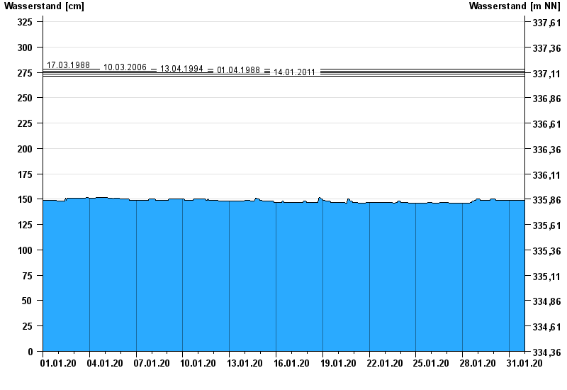
- 17.03.1988 Wasserstand: 278 cm
- 10.03.2006 Wasserstand: 276 cm
- 13.04.1994 Wasserstand: 275 cm
- 01.04.1988 Wasserstand: 273 cm
- 14.01.2011 Wasserstand: 271 cm
| Date | Waterlevel [cm] |
|---|---|
| 31.01.2020 23:45 | 149 |
| 31.01.2020 23:30 | 149 |
| 31.01.2020 23:15 | 149 |
| 31.01.2020 23:00 | 149 |
| 31.01.2020 22:45 | 149 |
| 31.01.2020 22:30 | 149 |
| 31.01.2020 22:15 | 149 |
© Bayerisches Landesamt für Umwelt 2024