
- Start >
- Rivers >
- Waterlevel >
- Obere Donau >
- Rasch >
- Chart of year

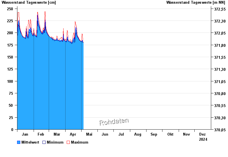
Chart of year Rasch / Schwarzach
Waterlevel from 01.01.2024 to 31.12.2024
- 26.01.1995 Wasserstand: 441 cm
- 21.12.1993 Wasserstand: 435 cm
- 02.07.1987 Wasserstand: 435 cm
- 02.03.1987 Wasserstand: 406 cm
- 22.02.1970 Wasserstand: 395 cm
| Date | Mean value [cm] | Maximum [cm] | Minimum [cm] |
|---|---|---|---|
| 17.05.2024 | 179 | 189 | 176 |
| 16.05.2024 | 176 | 178 | 175 |
| 15.05.2024 | 176 | 177 | 175 |
| 14.05.2024 | 176 | 177 | 176 |
| 13.05.2024 | 177 | 177 | 176 |
| 12.05.2024 | 177 | 177 | 177 |
| 11.05.2024 | 178 | 178 | 177 |
© Bayerisches Landesamt für Umwelt 2024