
- Start >
- Rivers >
- Waterlevel >
- Obere Donau >
- Rasch >
- Chart of month

Chart of month Rasch / Schwarzach
Waterlevel from 22.02.2023 to 21.03.2023
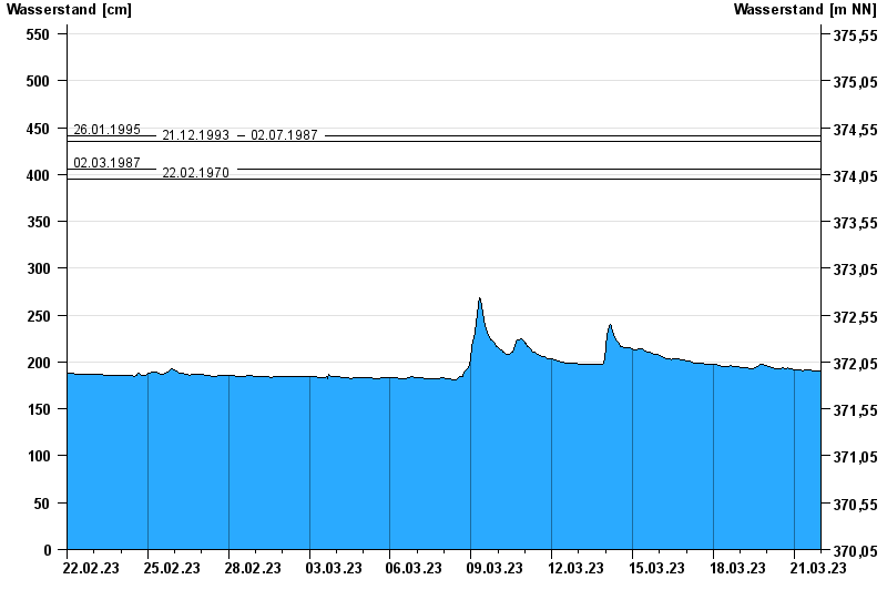
- 26.01.1995 Wasserstand: 441 cm
- 21.12.1993 Wasserstand: 435 cm
- 02.07.1987 Wasserstand: 435 cm
- 02.03.1987 Wasserstand: 406 cm
- 22.02.1970 Wasserstand: 395 cm
| Date | Waterlevel [cm] |
|---|---|
| 21.03.2023 23:45 | 191 |
| 21.03.2023 23:30 | 191 |
| 21.03.2023 23:15 | 191 |
| 21.03.2023 23:00 | 191 |
| 21.03.2023 22:45 | 191 |
| 21.03.2023 22:30 | 191 |
| 21.03.2023 22:15 | 191 |
© Bayerisches Landesamt für Umwelt 2024