
- Start >
- Rivers >
- Waterlevel >
- Obere Donau >
- Neumühle >
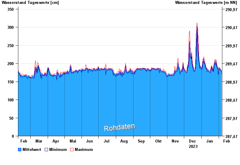
- Chart of year

Chart of year Neumühle / Rednitz
Waterlevel from 07.02.2023 to 06.02.2024
- 04.06.2013 Wasserstand: 469 cm
- 14.01.2011 Wasserstand: 461 cm
- 09.01.2011 Wasserstand: 450 cm
- 11.03.2006 Wasserstand: 436 cm
- 06.01.2018 Wasserstand: 423 cm
| Date | Mean value [cm] | Maximum [cm] | Minimum [cm] |
|---|---|---|---|
| 06.02.2024 | 178 | 181 | 170 |
| 05.02.2024 | 182 | 183 | 181 |
| 04.02.2024 | 183 | 184 | 182 |
| 03.02.2024 | 185 | 186 | 183 |
| 02.02.2024 | 187 | 190 | 185 |
| 01.02.2024 | 185 | 189 | 181 |
| 31.01.2024 | 184 | 186 | 169 |
© Bayerisches Landesamt für Umwelt 2024