
- Start >
- Rivers >
- Waterlevel >
- Obere Donau >
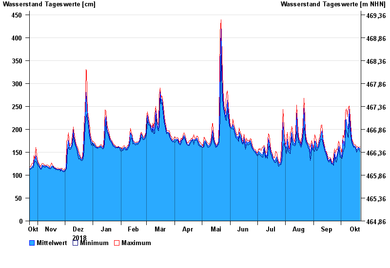
- Neu Ulm, Bad Held >
- Chart of year

Chart of year Neu Ulm, Bad Held / Donau
Waterlevel from 23.10.2018 to 22.10.2019
ACHTUNG!
Pegel durch außerordentlichen Kraftwerksbetrieb beeinflusst.
- 23.05.1999 Wasserstand: 571 cm
- 24.08.2005 Wasserstand: 543 cm
- 03.06.2013 Wasserstand: 502 cm
- 16.02.1990 Wasserstand: 471 cm
- 13.08.2002 Wasserstand: 469 cm
| Date | Mean value [cm] | Maximum [cm] | Minimum [cm] |
|---|---|---|---|
| 22.10.2019 | 158 | 162 | 151 |
| 21.10.2019 | 159 | 161 | 157 |
| 20.10.2019 | 160 | 162 | 155 |
| 19.10.2019 | 157 | 163 | 154 |
| 18.10.2019 | 155 | 160 | 150 |
| 17.10.2019 | 162 | 166 | 158 |
| 16.10.2019 | 164 | 167 | 162 |
© Bayerisches Landesamt für Umwelt 2024