
- Start >
- Rivers >
- Waterlevel >
- Obere Donau >
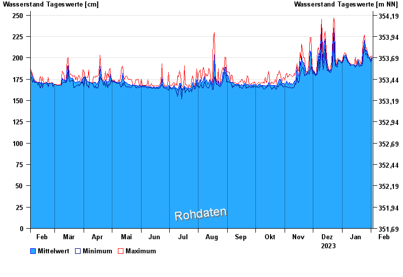
- Mühlstetten >
- Chart of year

Chart of year Mühlstetten / Schwäbische Rezat
Waterlevel from 03.02.2023 to 02.02.2024
- 13.04.1994 Wasserstand: 369 cm
- 21.12.1993 Wasserstand: 356 cm
- 21.02.1999 Wasserstand: 325 cm
- 18.03.2005 Wasserstand: 301 cm
- 29.10.1998 Wasserstand: 297 cm
| Date | Mean value [cm] | Maximum [cm] | Minimum [cm] |
|---|---|---|---|
| 02.02.2024 | 201 | 202 | 200 |
| 01.02.2024 | 198 | 202 | 195 |
| 31.01.2024 | 199 | 200 | 198 |
| 30.01.2024 | 200 | 201 | 199 |
| 29.01.2024 | 202 | 202 | 200 |
| 28.01.2024 | 204 | 207 | 200 |
| 27.01.2024 | 209 | 212 | 205 |
© Bayerisches Landesamt für Umwelt 2024