
- Start >
- Rivers >
- Waterlevel >
- Obere Donau >
- Mühlstetten >
- Chart of month

Chart of month Mühlstetten / Schwäbische Rezat
Waterlevel from 16.01.2020 to 15.02.2020
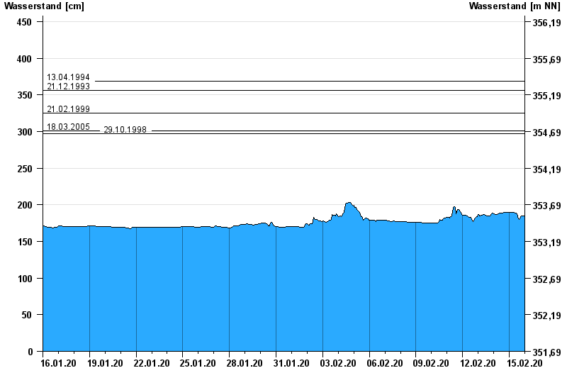
- 13.04.1994 Wasserstand: 369 cm
- 21.12.1993 Wasserstand: 356 cm
- 21.02.1999 Wasserstand: 325 cm
- 18.03.2005 Wasserstand: 301 cm
- 29.10.1998 Wasserstand: 297 cm
| Date | Waterlevel [cm] |
|---|---|
| 15.02.2020 23:45 | 185 |
| 15.02.2020 23:30 | 185 |
| 15.02.2020 23:15 | 185 |
| 15.02.2020 23:00 | 185 |
| 15.02.2020 22:45 | 185 |
| 15.02.2020 22:30 | 185 |
| 15.02.2020 22:15 | 185 |
© Bayerisches Landesamt für Umwelt 2024