
- Start >
- Rivers >
- Waterlevel >
- Obere Donau >
- Manching (Ort) >
- Current values

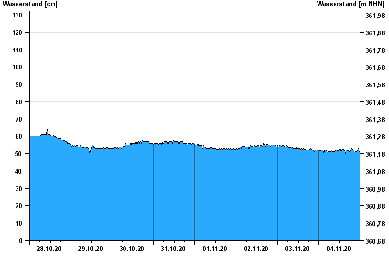
Current values Manching (Ort) / Paar
Waterlevel from 28.10.2020 to 04.11.2020
- 11.03.2006 Wasserstand: 285 cm
- 04.06.2013 Wasserstand: 284 cm
- 15.04.1994 Wasserstand: 279 cm
- 17.02.2006 Wasserstand: 228 cm
- 24.05.1999 Wasserstand: 226 cm
| Date | Waterlevel [cm] |
|---|---|
| 04.11.2020 23:45 | 51 |
| 04.11.2020 23:30 | 52 |
| 04.11.2020 23:15 | 53 |
| 04.11.2020 23:00 | 53 |
| 04.11.2020 22:45 | 52 |
| 04.11.2020 22:30 | 52 |
| 04.11.2020 22:15 | 51 |
© Bayerisches Landesamt für Umwelt 2024