
- Start >
- Rivers >
- Waterlevel >
- Obere Donau >
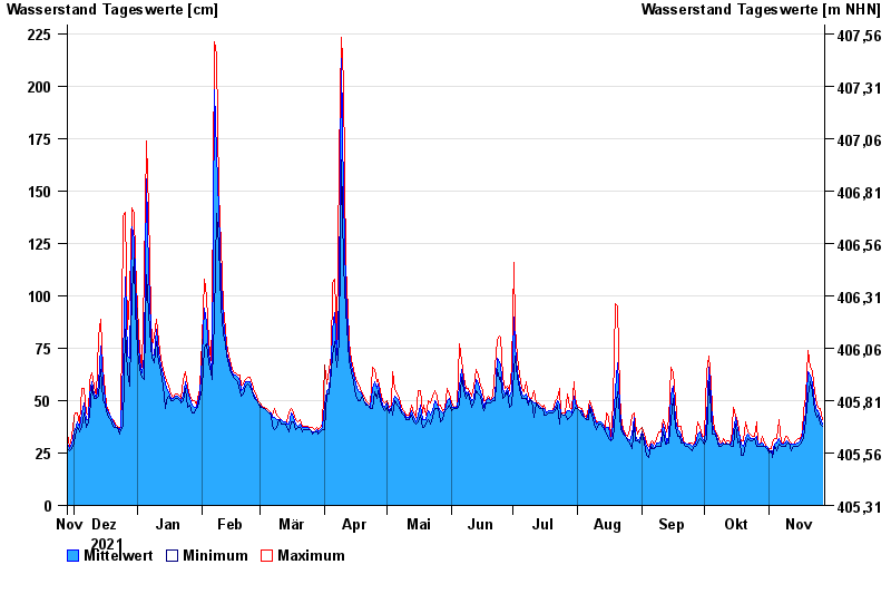
- Lierheim >
- Chart of year

Chart of year Lierheim / Eger
Waterlevel from 28.11.2021 to 27.11.2022
note
Abflussermittlung beeinflusst!
- 31.01.1982 Wasserstand: 340 cm
- 07.06.1984 Wasserstand: 339 cm
- 13.04.1994 Wasserstand: 335 cm
- 21.12.1993 Wasserstand: 328 cm
- 16.02.1990 Wasserstand: 323 cm
| Date | Mean value [cm] | Maximum [cm] | Minimum [cm] |
|---|---|---|---|
| 27.11.2022 | 39 | 41 | 38 |
| 26.11.2022 | 42 | 46 | 39 |
| 25.11.2022 | 45 | 47 | 43 |
| 24.11.2022 | 45 | 48 | 42 |
| 23.11.2022 | 49 | 54 | 45 |
| 22.11.2022 | 58 | 64 | 54 |
| 21.11.2022 | 62 | 66 | 59 |
© Bayerisches Landesamt für Umwelt 2024