
- Start >
- Rivers >
- Waterlevel >
- Obere Donau >
- Langerringen >
- Chart of year

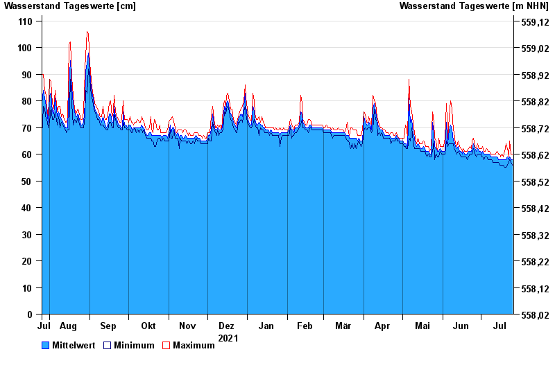
Chart of year Langerringen / Singold
Waterlevel from 26.07.2021 to 25.07.2022
- 22.05.1999 Wasserstand: 150 cm
- 07.08.2000 Wasserstand: 148 cm
- 12.08.2002 Wasserstand: 140 cm
- 01.08.2002 Wasserstand: 134 cm
- 07.06.1995 Wasserstand: 128 cm
| Date | Mean value [cm] | Maximum [cm] | Minimum [cm] |
|---|---|---|---|
| 25.07.2022 | 58 | 60 | 56 |
| 24.07.2022 | 58 | 60 | 57 |
| 23.07.2022 | 59 | 65 | 58 |
| 22.07.2022 | 58 | 59 | 57 |
| 21.07.2022 | 59 | 62 | 56 |
| 20.07.2022 | 58 | 64 | 55 |
| 19.07.2022 | 58 | 61 | 55 |
© Bayerisches Landesamt für Umwelt 2024