
- Start >
- Rivers >
- Waterlevel >
- Obere Donau >
- Langengeisling >
- Chart of year

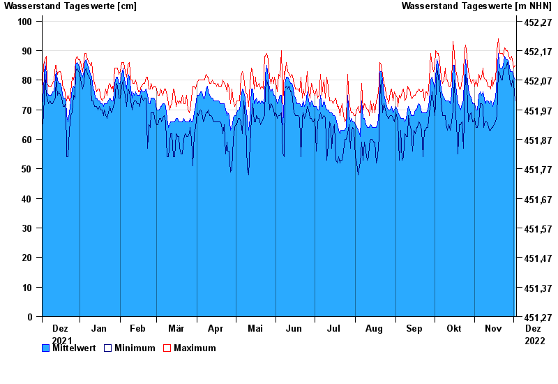
Chart of year Langengeisling / Sempt
Waterlevel from 03.12.2021 to 02.12.2022
- 08.01.1985 Wasserstand: 124 cm
- 27.10.1978 Wasserstand: 123 cm
- 29.06.1995 Wasserstand: 121 cm
- 02.06.2013 Wasserstand: 120 cm
- 30.09.1978 Wasserstand: 119 cm
| Date | Mean value [cm] | Maximum [cm] | Minimum [cm] |
|---|---|---|---|
| 02.12.2022 | 80 | 85 | 73 |
| 01.12.2022 | 81 | 84 | 79 |
| 30.11.2022 | 83 | 87 | 80 |
| 29.11.2022 | 83 | 88 | 78 |
| 28.11.2022 | 83 | 87 | 79 |
| 27.11.2022 | 86 | 88 | 83 |
| 26.11.2022 | 87 | 90 | 86 |
© Bayerisches Landesamt für Umwelt 2024