
- Start >
- Rivers >
- Waterlevel >
- Obere Donau >
- Langengeisling >
- Chart of month

Chart of month Langengeisling / Sempt
Waterlevel from 29.05.2022 to 28.06.2022
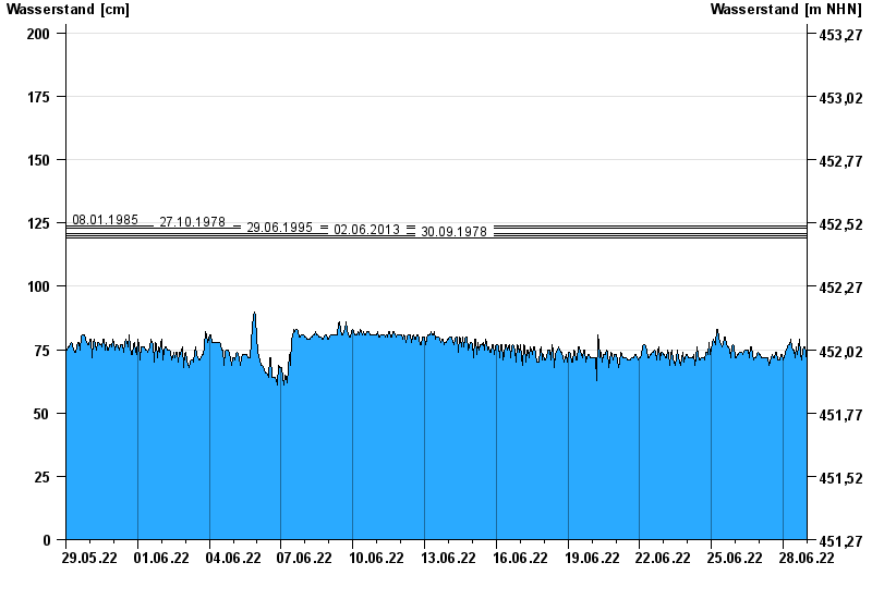
- 08.01.1985 Wasserstand: 124 cm
- 27.10.1978 Wasserstand: 123 cm
- 29.06.1995 Wasserstand: 121 cm
- 02.06.2013 Wasserstand: 120 cm
- 30.09.1978 Wasserstand: 119 cm
| Date | Waterlevel [cm] |
|---|---|
| 29.06.2022 00:45 | 68 |
| 29.06.2022 00:30 | 68 |
| 29.06.2022 00:15 | 69 |
| 29.06.2022 00:00 | 69 |
| 28.06.2022 23:45 | 69 |
| 28.06.2022 23:30 | 70 |
| 28.06.2022 23:15 | 71 |
© Bayerisches Landesamt für Umwelt 2024