
- Start >
- Rivers >
- Waterlevel >
- Obere Donau >
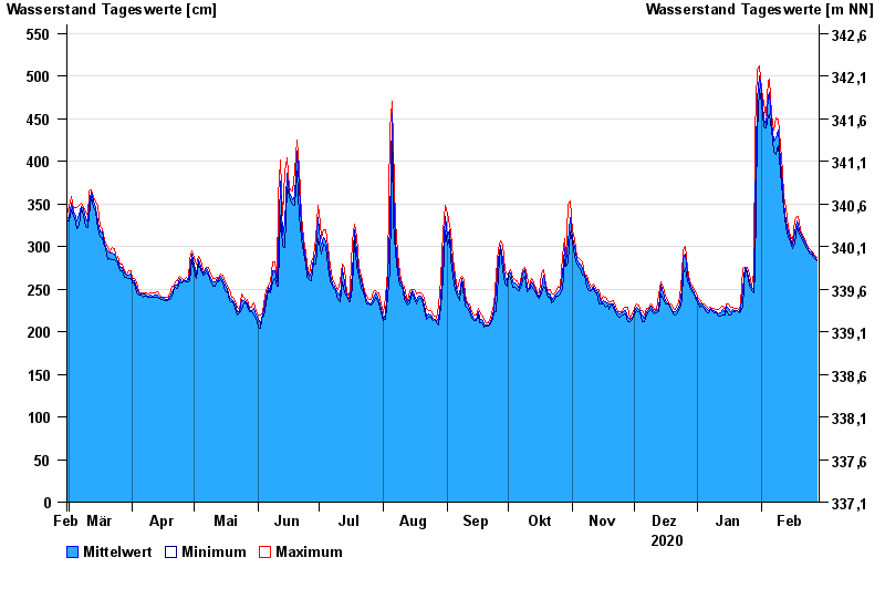
- Kelheim >
- Chart of year

Chart of year Kelheim / Donau
Waterlevel from 29.02.2020 to 28.02.2021
- 24.05.1999 Wasserstand: 796 cm
- 25.08.2005 Wasserstand: 729 cm
- 13.06.1965 Wasserstand: 725 cm
- 04.06.2013 Wasserstand: 716 cm
- 14.08.2002 Wasserstand: 699 cm
| Date | Mean value [cm] | Maximum [cm] | Minimum [cm] |
|---|---|---|---|
| 28.02.2021 | 285 | 287 | 283 |
| 27.02.2021 | 288 | 290 | 286 |
| 26.02.2021 | 291 | 294 | 288 |
| 25.02.2021 | 293 | 295 | 291 |
| 24.02.2021 | 294 | 298 | 292 |
| 23.02.2021 | 301 | 302 | 298 |
| 22.02.2021 | 305 | 309 | 302 |
© Bayerisches Landesamt für Umwelt 2024