
- Start >
- Rivers >
- Waterlevel >
- Obere Donau >
- Heroldingen >
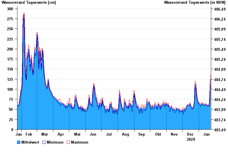
- Chart of year

Chart of year Heroldingen / Wörnitz
Waterlevel from 24.01.2020 to 23.01.2021
- 21.12.1993 Wasserstand: 484 cm
- 14.04.1994 Wasserstand: 482 cm
- 30.10.1998 Wasserstand: 416 cm
- 17.03.1988 Wasserstand: 415 cm
- 31.01.1982 Wasserstand: 395 cm
| Date | Mean value [cm] | Maximum [cm] | Minimum [cm] |
|---|---|---|---|
| 23.01.2021 | 125 | 136 | 110 |
| 22.01.2021 | 85 | 110 | 66 |
| 21.01.2021 | 62 | 67 | 57 |
| 20.01.2021 | 62 | 65 | 59 |
| 19.01.2021 | 58 | 59 | 58 |
| 18.01.2021 | 58 | 60 | 57 |
| 17.01.2021 | 60 | 63 | 58 |
© Bayerisches Landesamt für Umwelt 2024