
- Start >
- Rivers >
- Waterlevel >
- Obere Donau >
- Heroldingen >
- Chart of year

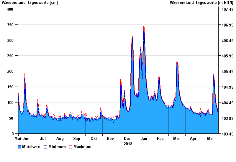
Chart of year Heroldingen / Wörnitz
Waterlevel from 31.05.2018 to 30.05.2019
| Date | Mean value [cm] | Maximum [cm] | Minimum [cm] |
|---|---|---|---|
| 30.05.2019 | 73 | 77 | 68 |
| 29.05.2019 | 80 | 85 | 76 |
| 28.05.2019 | 85 | 88 | 83 |
| 27.05.2019 | 89 | 95 | 86 |
| 26.05.2019 | 102 | 109 | 95 |
| 25.05.2019 | 116 | 132 | 109 |
| 24.05.2019 | 153 | 168 | 132 |
© Bayerisches Landesamt für Umwelt 2024