
- Start >
- Rivers >
- Waterlevel >
- Obere Donau >
- Heroldingen >
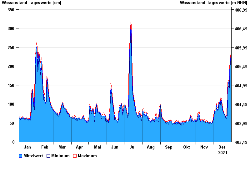
- Chart of year

Chart of year Heroldingen / Wörnitz
Waterlevel from 01.01.2021 to 31.12.2021
- 21.12.1993 Wasserstand: 484 cm
- 14.04.1994 Wasserstand: 482 cm
- 30.10.1998 Wasserstand: 416 cm
- 17.03.1988 Wasserstand: 415 cm
- 31.01.1982 Wasserstand: 395 cm
| Date | Mean value [cm] | Maximum [cm] | Minimum [cm] |
|---|---|---|---|
| 31.12.2021 | 227 | 232 | 220 |
| 30.12.2021 | 210 | 220 | 198 |
| 29.12.2021 | 186 | 198 | 151 |
| 28.12.2021 | 137 | 151 | 132 |
| 27.12.2021 | 158 | 163 | 148 |
| 26.12.2021 | 160 | 163 | 145 |
| 25.12.2021 | 94 | 145 | 71 |
© Bayerisches Landesamt für Umwelt 2024