
- Start >
- Rivers >
- Waterlevel >
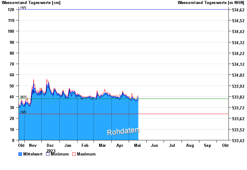
- Obere Donau >
- Hasberg >
- Chart of year

Chart of year Hasberg / Östliche Mindel
Waterlevel from 22.10.2023 to 21.10.2024
| Date | Mean value [cm] | Maximum [cm] | Minimum [cm] |
|---|---|---|---|
| 06.06.2024 | 47 | 48 | 46 |
| 05.06.2024 | 49 | 50 | 47 |
| 04.06.2024 | 53 | 57 | 50 |
| 03.06.2024 | 61 | 64 | 57 |
| 02.06.2024 | 83 | 120 | 63 |
| 01.06.2024 | 110 | 122 | 86 |
| 31.05.2024 | 56 | 86 | 45 |
© Bayerisches Landesamt für Umwelt 2024