
- Start >
- Rivers >
- Waterlevel >
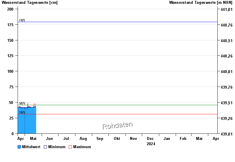
- Obere Donau >
- Freising >
- Chart of year

Chart of year Freising / Schleifermoosach
Waterlevel from 18.04.2024 to 17.04.2025
| Date | Mean value [cm] | Maximum [cm] | Minimum [cm] |
|---|---|---|---|
| 01.06.2024 | 99 | 152 | 75 |
| 31.05.2024 | 57 | 76 | 48 |
| 30.05.2024 | 49 | 50 | 48 |
| 29.05.2024 | 51 | 53 | 49 |
| 28.05.2024 | 52 | 55 | 47 |
| 27.05.2024 | 44 | 50 | 44 |
| 26.05.2024 | 44 | 45 | 44 |
© Bayerisches Landesamt für Umwelt 2024