
- Start >
- Rivers >
- Waterlevel >
- Obere Donau >
- Freising >
- Current values

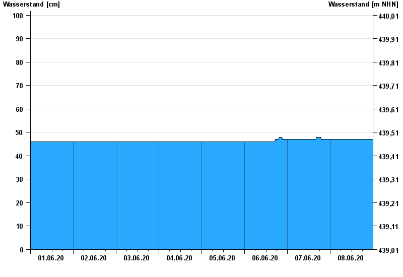
Current values Freising / Schleifermoosach
Waterlevel from 01.06.2020 to 08.06.2020
- 02.06.2013 Wasserstand: 231 cm
- 24.08.2005 Wasserstand: 179 cm
- 23.05.1999 Wasserstand: 160 cm
- 02.06.1995 Wasserstand: 158 cm
- 12.08.2002 Wasserstand: 155 cm
| Date | Waterlevel [cm] |
|---|---|
| 09.06.2020 00:45 | 47 |
| 09.06.2020 00:30 | 47 |
| 09.06.2020 00:15 | 47 |
| 09.06.2020 00:00 | 47 |
| 08.06.2020 23:45 | 47 |
| 08.06.2020 23:30 | 47 |
| 08.06.2020 23:15 | 47 |
© Bayerisches Landesamt für Umwelt 2024