
- Start >
- Rivers >
- Waterlevel >
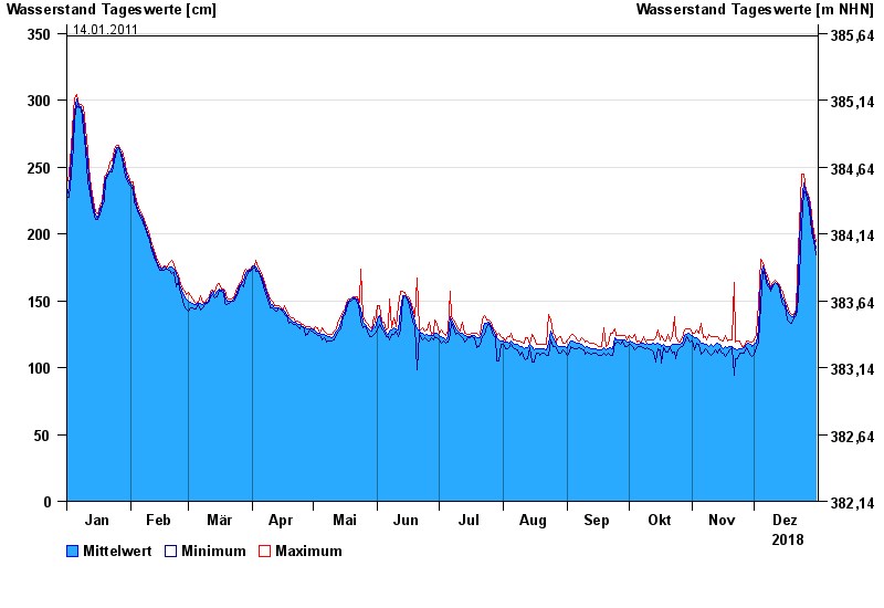
- Obere Donau >
- Eichstätt >
- Chart of year

Chart of year Eichstätt / Altmühl
Waterlevel from 01.01.2018 to 31.12.2018
- 19.03.1988 Wasserstand: 374 cm
- 23.12.1993 Wasserstand: 368 cm
- 16.04.1994 Wasserstand: 366 cm
- 05.03.1987 Wasserstand: 352 cm
- 14.01.2011 Wasserstand: 348 cm
| Date | Mean value [cm] | Maximum [cm] | Minimum [cm] |
|---|---|---|---|
| 31.12.2018 | 189 | 194 | 184 |
| 30.12.2018 | 198 | 202 | 194 |
| 29.12.2018 | 207 | 213 | 202 |
| 28.12.2018 | 218 | 223 | 210 |
| 27.12.2018 | 227 | 229 | 223 |
| 26.12.2018 | 231 | 232 | 229 |
| 25.12.2018 | 238 | 245 | 232 |
© Bayerisches Landesamt für Umwelt 2024