
- Start >
- Rivers >
- Waterlevel >
- Obere Donau >
- Eichstätt >
- Chart of month

Chart of month Eichstätt / Altmühl
Waterlevel from 01.03.2024 to 31.03.2024
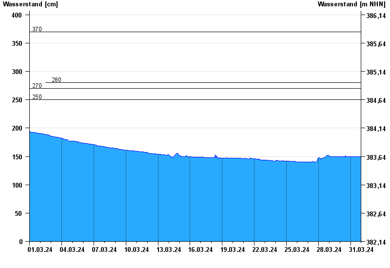
- 250 cm: Eichstätt: Ausuferung Campingplatz Kipfenberg.
- 270 cm: Dollnstein: Ausuferung Campingplatz unterhalb.
- 280 cm: Eichstätt: Beginn der Ausuferung unterhalb.
| Date | Waterlevel [cm] |
|---|---|
| 01.04.2024 00:45 | 150 |
| 01.04.2024 00:30 | 150 |
| 01.04.2024 00:15 | 150 |
| 01.04.2024 00:00 | 150 |
| 31.03.2024 23:45 | 150 |
| 31.03.2024 23:30 | 150 |
| 31.03.2024 23:15 | 150 |
© Bayerisches Landesamt für Umwelt 2024