
- Start >
- Rivers >
- Waterlevel >
- Obere Donau >
- Dasing >
- Chart of year

Chart of year Dasing / Paar
Waterlevel from 27.04.2024 to 26.04.2025
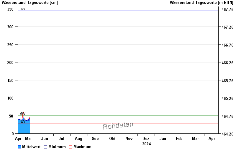
| Date | Mean value [cm] | Maximum [cm] | Minimum [cm] |
|---|---|---|---|
| 07.05.2024 | 52 | 61 | 47 |
| 06.05.2024 | 42 | 61 | 36 |
| 05.05.2024 | 39 | 40 | 38 |
| 04.05.2024 | 39 | 41 | 38 |
| 03.05.2024 | 39 | 40 | 38 |
| 02.05.2024 | 39 | 41 | 38 |
| 01.05.2024 | 39 | 40 | 39 |
© Bayerisches Landesamt für Umwelt 2024