
- Start >
- Rivers >
- Waterlevel >
- Obere Donau >
- Beilngries oberh. der Sulz >
- Chart of month

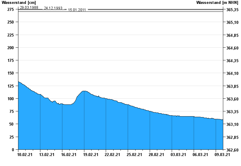
Chart of month Beilngries oberh. der Sulz / Altmühl
Waterlevel from 10.02.2021 to 09.03.2021
- 18.03.1988 Wasserstand: 299 cm
- 03.03.1987 Wasserstand: 288 cm
- 29.03.1988 Wasserstand: 275 cm
- 24.12.1993 Wasserstand: 274 cm
- 15.01.2011 Wasserstand: 270 cm
| Date | Waterlevel [cm] |
|---|---|
| 09.03.2021 23:45 | 59 |
| 09.03.2021 23:30 | 59 |
| 09.03.2021 23:15 | 59 |
| 09.03.2021 23:00 | 59 |
| 09.03.2021 22:45 | 59 |
| 09.03.2021 22:30 | 59 |
| 09.03.2021 22:15 | 58 |
© Bayerisches Landesamt für Umwelt 2024