
- Start >
- Rivers >
- Waterlevel >
- Obere Donau >
- Appolding >
- Current values

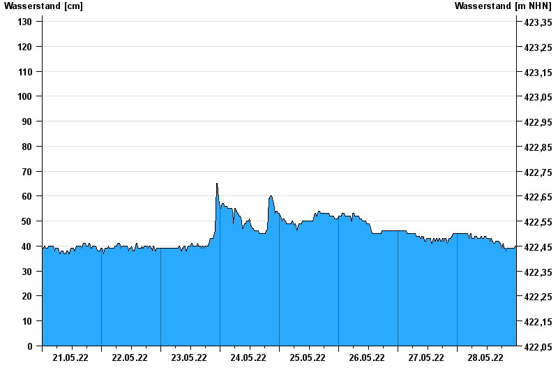
Current values Appolding / Strogen
Waterlevel from 21.05.2022 to 28.05.2022
- 09.06.1965 Wasserstand: 308 cm
- 01.06.1965 Wasserstand: 286 cm
- 03.06.2013 Wasserstand: 271 cm
- 02.08.1991 Wasserstand: 256 cm
- 15.02.1990 Wasserstand: 233 cm
| Date | Waterlevel [cm] |
|---|---|
| 29.05.2022 00:45 | 40 |
| 29.05.2022 00:30 | 41 |
| 29.05.2022 00:15 | 41 |
| 29.05.2022 00:00 | 40 |
| 28.05.2022 23:45 | 40 |
| 28.05.2022 23:30 | 40 |
| 28.05.2022 23:15 | 39 |
© Bayerisches Landesamt für Umwelt 2024