
- Start >
- Rivers >
- Waterlevel >
- Isar >
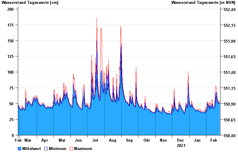
- Weilheim >
- Chart of year

Chart of year Weilheim / Ammer
Waterlevel from 26.02.2021 to 25.02.2022
- 22.05.1999 Wasserstand: 523 cm
- 07.07.1946 Wasserstand: 514 cm
- 23.08.2005 Wasserstand: 478 cm
- 18.06.1979 Wasserstand: 433 cm
- 10.08.1970 Wasserstand: 422 cm
| Date | Mean value [cm] | Maximum [cm] | Minimum [cm] |
|---|---|---|---|
| 25.02.2022 | 51 | 52 | 50 |
| 24.02.2022 | 52 | 55 | 50 |
| 23.02.2022 | 53 | 55 | 50 |
| 22.02.2022 | 51 | 52 | 50 |
| 21.02.2022 | 52 | 53 | 51 |
| 20.02.2022 | 57 | 66 | 53 |
| 19.02.2022 | 68 | 77 | 62 |
© Bayerisches Landesamt für Umwelt 2024