
- Start >
- Rivers >
- Waterlevel >
- Isar >
- Weilheim >
- Chart of year

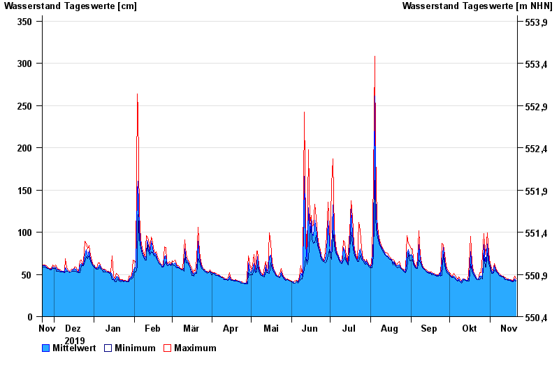
Chart of year Weilheim / Ammer
Waterlevel from 22.11.2019 to 21.11.2020
- 22.05.1999 Wasserstand: 523 cm
- 07.07.1946 Wasserstand: 514 cm
- 23.08.2005 Wasserstand: 478 cm
- 18.06.1979 Wasserstand: 433 cm
- 10.08.1970 Wasserstand: 422 cm
| Date | Mean value [cm] | Maximum [cm] | Minimum [cm] |
|---|---|---|---|
| 21.11.2020 | 43 | 45 | 42 |
| 20.11.2020 | 45 | 48 | 43 |
| 19.11.2020 | 42 | 43 | 41 |
| 18.11.2020 | 42 | 43 | 41 |
| 17.11.2020 | 43 | 44 | 42 |
| 16.11.2020 | 44 | 44 | 43 |
| 15.11.2020 | 44 | 45 | 43 |
© Bayerisches Landesamt für Umwelt 2024