
- Start >
- Rivers >
- Waterlevel >
- Isar >
- Unterfinning >
- Current values

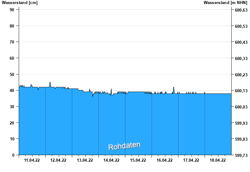
Current values Unterfinning / Windach
Waterlevel from 11.04.2022 to 18.04.2022
note
Pegel beeinflusst durch Kraftwerkssteuerung
- 01.06.2024 Wasserstand: 163 cm
- 21.05.2019 Wasserstand: 135 cm
- 03.02.2020 Wasserstand: 115 cm
- 22.01.2018 Wasserstand: 113 cm
- 12.12.2023 Wasserstand: 112 cm
| Date | Waterlevel [cm] |
|---|---|
| 19.04.2022 00:45 | 38 |
| 19.04.2022 00:30 | 38 |
| 19.04.2022 00:15 | 38 |
| 19.04.2022 00:00 | 38 |
| 18.04.2022 23:45 | 38 |
| 18.04.2022 23:30 | 38 |
| 18.04.2022 23:15 | 38 |
© Bayerisches Landesamt für Umwelt 2025