
- Start >
- Rivers >
- Waterlevel >
- Isar >
- Tutzing >
- Current values

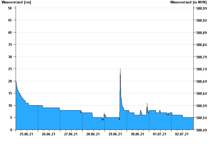
Current values Tutzing / Kalkgraben
Waterlevel from 25.06.2021 to 02.07.2021
- 11.07.1989 Wasserstand: 107 cm
- 18.05.2002 Wasserstand: 70 cm
- 27.06.2009 Wasserstand: 69 cm
- 20.07.2004 Wasserstand: 64 cm
- 29.05.2007 Wasserstand: 60 cm
| Date | Waterlevel [cm] |
|---|---|
| 03.07.2021 00:45 | 5 |
| 03.07.2021 00:30 | 5 |
| 03.07.2021 00:15 | 5 |
| 03.07.2021 00:00 | 5 |
| 02.07.2021 23:45 | 5 |
| 02.07.2021 23:30 | 5 |
| 02.07.2021 23:15 | 5 |
© Bayerisches Landesamt für Umwelt 2024