
- Start >
- Rivers >
- Waterlevel >
- Isar >
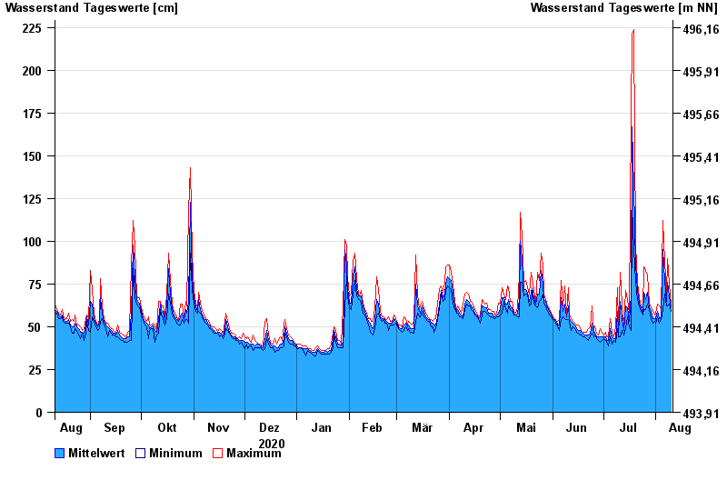
- Stein bei Altenmarkt >
- Chart of year

Chart of year Stein bei Altenmarkt / Traun
Waterlevel from 11.08.2020 to 10.08.2021
- 12.08.2002 Wasserstand: 367 cm
- 02.06.2013 Wasserstand: 347 cm
- 26.06.1995 Wasserstand: 330 cm
- 01.08.1977 Wasserstand: 329 cm
- 20.07.1981 Wasserstand: 328 cm
| Date | Mean value [cm] | Maximum [cm] | Minimum [cm] |
|---|---|---|---|
| 10.08.2021 | 61 | 63 | 59 |
| 09.08.2021 | 68 | 75 | 63 |
| 08.08.2021 | 76 | 90 | 62 |
| 07.08.2021 | 65 | 69 | 62 |
| 06.08.2021 | 77 | 88 | 69 |
| 05.08.2021 | 95 | 112 | 60 |
| 04.08.2021 | 56 | 60 | 54 |
© Bayerisches Landesamt für Umwelt 2024