
- Start >
- Rivers >
- Waterlevel >
- Isar >
- Siegsdorf >
- Chart of month

Chart of month Siegsdorf / Weiße Traun
Waterlevel from 01.08.2021 to 31.08.2021
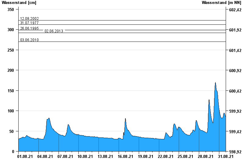
- 12.08.2002 Wasserstand: 323 cm
- 31.07.1977 Wasserstand: 312 cm
- 26.06.1995 Wasserstand: 299 cm
- 02.06.2013 Wasserstand: 292 cm
- 03.06.2010 Wasserstand: 270 cm
| Date | Waterlevel [cm] |
|---|---|
| 01.09.2021 00:45 | 81 |
| 01.09.2021 00:30 | 82 |
| 01.09.2021 00:15 | 83 |
| 01.09.2021 00:00 | 83 |
| 31.08.2021 23:45 | 84 |
| 31.08.2021 23:30 | 83 |
| 31.08.2021 23:15 | 84 |
© Bayerisches Landesamt für Umwelt 2024