
- Start >
- Rivers >
- Waterlevel >
- Isar >
- Schmerold >
- Chart of year

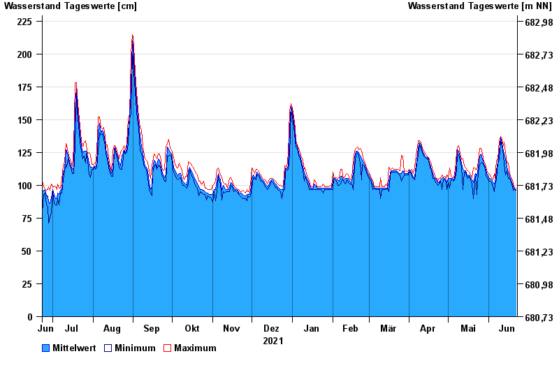
Chart of year Schmerold / Mangfall
Waterlevel from 23.06.2021 to 22.06.2022
- 02.06.2013 Wasserstand: 358 cm
- 22.05.1999 Wasserstand: 322 cm
- 23.08.2005 Wasserstand: 316 cm
- 20.07.1981 Wasserstand: 299 cm
- 03.06.2010 Wasserstand: 268 cm
| Date | Mean value [cm] | Maximum [cm] | Minimum [cm] |
|---|---|---|---|
| 22.06.2022 | 97 | 98 | 96 |
| 21.06.2022 | 97 | 98 | 97 |
| 20.06.2022 | 99 | 101 | 96 |
| 19.06.2022 | 101 | 104 | 99 |
| 18.06.2022 | 104 | 106 | 102 |
| 17.06.2022 | 107 | 109 | 105 |
| 16.06.2022 | 110 | 117 | 105 |
© Bayerisches Landesamt für Umwelt 2024