
- Start >
- Rivers >
- Waterlevel >
- Isar >
- Schmerold >
- Chart of month

Chart of month Schmerold / Mangfall
Waterlevel from 26.06.2021 to 25.07.2021
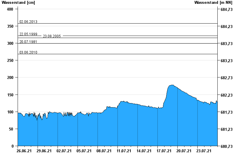
- 02.06.2013 Wasserstand: 358 cm
- 22.05.1999 Wasserstand: 322 cm
- 23.08.2005 Wasserstand: 316 cm
- 20.07.1981 Wasserstand: 299 cm
- 03.06.2010 Wasserstand: 268 cm
| Date | Waterlevel [cm] |
|---|---|
| 26.07.2021 00:45 | 127 |
| 26.07.2021 00:30 | 128 |
| 26.07.2021 00:15 | 128 |
| 26.07.2021 00:00 | 128 |
| 25.07.2021 23:45 | 128 |
| 25.07.2021 23:30 | 128 |
| 25.07.2021 23:15 | 128 |
© Bayerisches Landesamt für Umwelt 2024