
- Start >
- Rivers >
- Waterlevel >
- Isar >
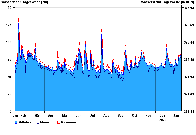
- Rottersdorf >
- Chart of year

Chart of year Rottersdorf / Vils
Waterlevel from 27.01.2020 to 26.01.2021
- 03.06.2013 Wasserstand: 280 cm
- 21.02.1999 Wasserstand: 255 cm
- 04.08.1991 Wasserstand: 252 cm
- 31.03.2000 Wasserstand: 226 cm
- 14.04.1994 Wasserstand: 226 cm
| Date | Mean value [cm] | Maximum [cm] | Minimum [cm] |
|---|---|---|---|
| 26.01.2021 | 77 | 78 | 75 |
| 25.01.2021 | 81 | 83 | 77 |
| 24.01.2021 | 82 | 83 | 81 |
| 23.01.2021 | 78 | 82 | 75 |
| 22.01.2021 | 76 | 79 | 75 |
| 21.01.2021 | 80 | 82 | 78 |
| 20.01.2021 | 74 | 78 | 71 |
© Bayerisches Landesamt für Umwelt 2024