
- Start >
- Rivers >
- Waterlevel >
- Isar >
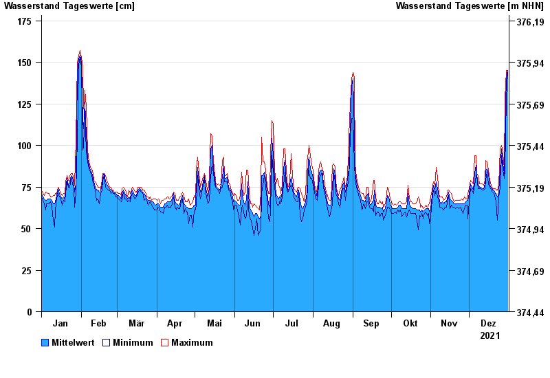
- Rottersdorf >
- Chart of year

Chart of year Rottersdorf / Vils
Waterlevel from 01.01.2021 to 31.12.2021
- 03.06.2013 Wasserstand: 280 cm
- 21.02.1999 Wasserstand: 255 cm
- 04.08.1991 Wasserstand: 252 cm
- 31.03.2000 Wasserstand: 226 cm
- 14.04.1994 Wasserstand: 226 cm
| Date | Mean value [cm] | Maximum [cm] | Minimum [cm] |
|---|---|---|---|
| 31.12.2021 | 145 | 145 | 144 |
| 30.12.2021 | 140 | 145 | 128 |
| 29.12.2021 | 110 | 128 | 85 |
| 28.12.2021 | 83 | 86 | 80 |
| 27.12.2021 | 89 | 95 | 85 |
| 26.12.2021 | 98 | 100 | 94 |
| 25.12.2021 | 85 | 98 | 75 |
© Bayerisches Landesamt für Umwelt 2024