
- Start >
- Rivers >
- Waterlevel >
- Isar >
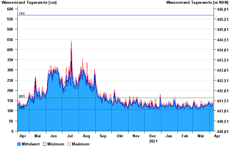
- Rosenheim o.d. Mangfallmündung >
- Chart of year

Chart of year Rosenheim o.d. Mangfallmündung / Inn
Waterlevel from 09.04.2021 to 08.04.2022
| Date | Mean value [cm] | Maximum [cm] | Minimum [cm] |
|---|---|---|---|
| 08.04.2022 | 136 | 144 | 130 |
| 07.04.2022 | 135 | 139 | 129 |
| 06.04.2022 | 136 | 144 | 128 |
| 05.04.2022 | 123 | 137 | 117 |
| 04.04.2022 | 125 | 130 | 119 |
| 03.04.2022 | 133 | 136 | 128 |
| 02.04.2022 | 133 | 137 | 131 |
© Bayerisches Landesamt für Umwelt 2024