
- Start >
- Rivers >
- Waterlevel >
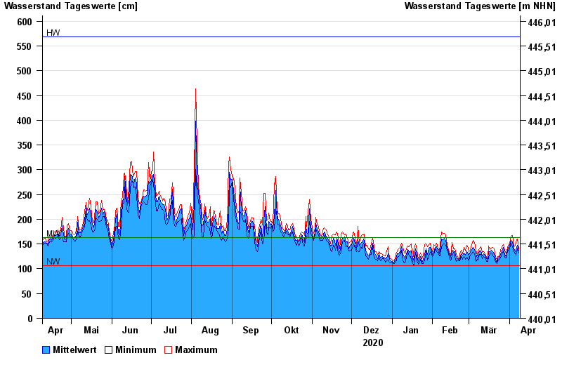
- Isar >
- Rosenheim o.d. Mangfallmündung >
- Chart of year

Chart of year Rosenheim o.d. Mangfallmündung / Inn
Waterlevel from 09.04.2020 to 08.04.2021
| Date | Mean value [cm] | Maximum [cm] | Minimum [cm] |
|---|---|---|---|
| 08.04.2021 | 137 | 141 | 132 |
| 07.04.2021 | 148 | 160 | 140 |
| 06.04.2021 | 139 | 155 | 127 |
| 05.04.2021 | 135 | 147 | 130 |
| 04.04.2021 | 140 | 145 | 135 |
| 03.04.2021 | 155 | 167 | 144 |
| 02.04.2021 | 158 | 166 | 151 |
© Bayerisches Landesamt für Umwelt 2024