
- Start >
- Rivers >
- Waterlevel >
- Isar >
- Reit im Winkl >
- Chart of month

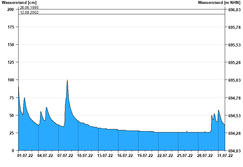
Chart of month Reit im Winkl / Schwarzlofer
Waterlevel from 01.07.2022 to 31.07.2022
- 17.07.2021 Wasserstand: 222 cm
- 02.06.2013 Wasserstand: 220 cm
- 08.08.1991 Wasserstand: 204 cm
- 26.06.1995 Wasserstand: 200 cm
- 12.08.2002 Wasserstand: 193 cm
| Date | Waterlevel [cm] |
|---|---|
| 01.08.2022 00:45 | 35 |
| 01.08.2022 00:30 | 35 |
| 01.08.2022 00:15 | 35 |
| 01.08.2022 00:00 | 35 |
| 31.07.2022 23:45 | 36 |
| 31.07.2022 23:30 | 36 |
| 31.07.2022 23:15 | 36 |
© Bayerisches Landesamt für Umwelt 2025