
- Start >
- Rivers >
- Waterlevel >
- Isar >
- Raisting >
- Chart of year

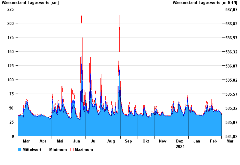
Chart of year Raisting / Rott
Waterlevel from 02.03.2021 to 01.03.2022
- 21.05.1999 Wasserstand: 321 cm
- 18.06.1986 Wasserstand: 314 cm
- 17.06.1979 Wasserstand: 310 cm
- 07.11.1979 Wasserstand: 301 cm
- 08.08.1978 Wasserstand: 293 cm
| Date | Mean value [cm] | Maximum [cm] | Minimum [cm] |
|---|---|---|---|
| 01.03.2022 | 39 | 40 | 38 |
| 28.02.2022 | 40 | 42 | 40 |
| 27.02.2022 | 42 | 43 | 41 |
| 26.02.2022 | 43 | 43 | 42 |
| 25.02.2022 | 43 | 44 | 43 |
| 24.02.2022 | 46 | 48 | 44 |
| 23.02.2022 | 45 | 48 | 44 |
© Bayerisches Landesamt für Umwelt 2024