
- Start >
- Rivers >
- Waterlevel >
- Isar >
- Puppling >
- Chart of year

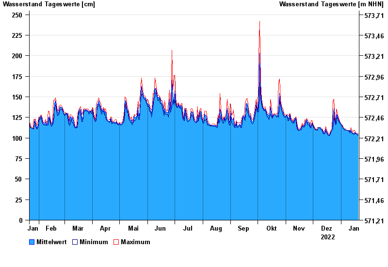
Chart of year Puppling / Isar
Waterlevel from 21.01.2022 to 20.01.2023
- 23.08.2005 Wasserstand: 459 cm
- 18.06.1979 Wasserstand: 441 cm
- 22.05.1999 Wasserstand: 430 cm
- 20.07.1981 Wasserstand: 426 cm
- 01.08.1977 Wasserstand: 418 cm
| Date | Mean value [cm] | Maximum [cm] | Minimum [cm] |
|---|---|---|---|
| 20.01.2023 | 104 | 105 | 103 |
| 19.01.2023 | 105 | 105 | 104 |
| 18.01.2023 | 105 | 106 | 105 |
| 17.01.2023 | 105 | 106 | 105 |
| 16.01.2023 | 107 | 109 | 106 |
| 15.01.2023 | 106 | 109 | 104 |
| 14.01.2023 | 106 | 107 | 105 |
© Bayerisches Landesamt für Umwelt 2024